The guidebook says that one should allow 3-4 hours and silly me, I was thinking it was because of its vast space. Well, I was partially right; it is vast but the guidebook didn't mention that most of the entire thing is up the mountain! We had been experiencing rainy weather up to this point and we were supposed to get a break from it while still being cool. I told the kids to wear long pants & jacket which wasn't necessary since it was warmer than I anticipated. But better to be safe than sorry. ;)
Prepare for lots of walking and not just walking, more like hiking on paved steps. The maps are not the clearest although at first glance they appear to be as we found out and somehow got separated from the kids at some point. There was a fork in the road which a sign pointed back down to the entrance that we assumed the kids would go but we were pleasantly surprised to see them near the top (we thought) an hour later of climbing. The paths are winding and seem to go up for a while making us think we are getting close to the top then go back down for another portion.
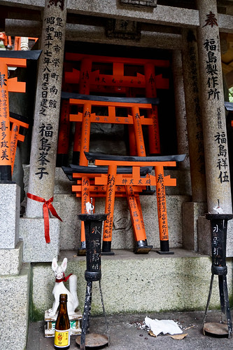
What kept me and Hector going was seeing the elderly men and women (65 + years) coming back down. If these people can do this, so can we !?! There are areas that are flat with rest stations that offer souvenirs and food/drink. There are also areas of shrines that are decorated with all sorts of items.
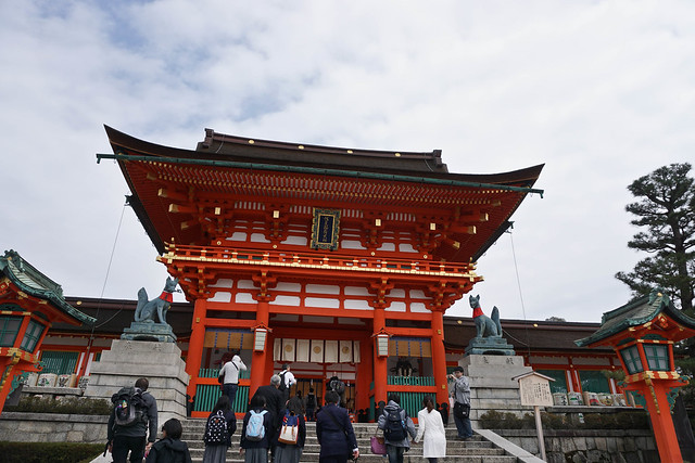
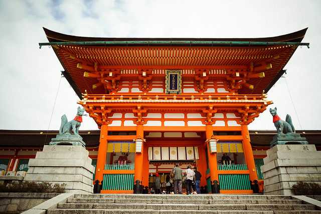
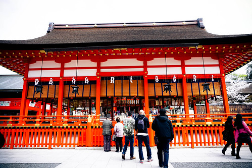
Now on to the shrine...
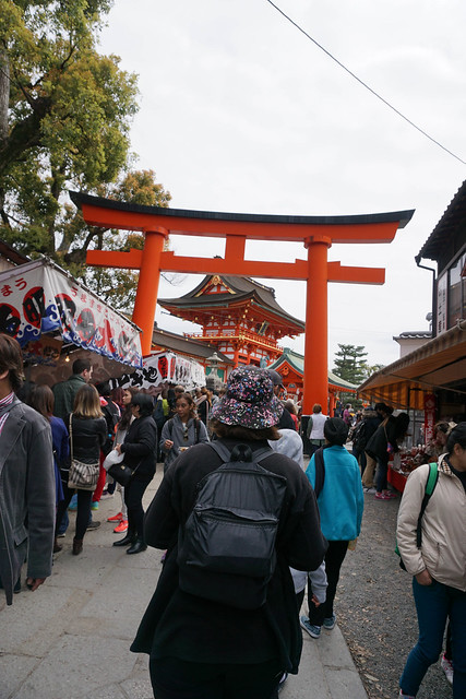
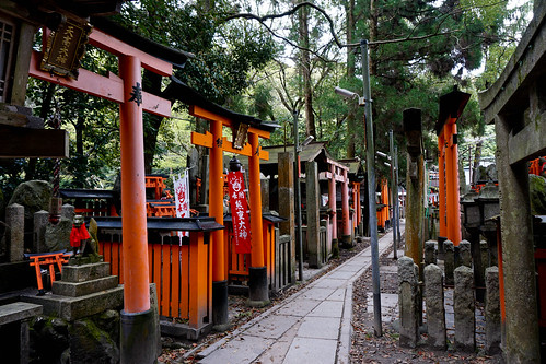
This is the area leading to the shrine. Just follow the torii gates both sides of this area is packed with street food vendors. We ate after visiting the shrine so I don't remember if I took pictures but I remember we had karaage (chicken pieces), crab on a stick and a pastry shaped like a fish filled with custard. I really wanted to go back and but we didn't have the time during our trip.
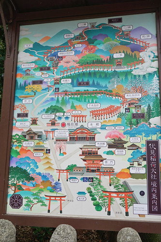
Now here is one of several posted maps showing the layout and definitely not to scale. At the time, we saw the red dot to indicate you are here and we"ll check where the dot is at another location. It didn't seem to move which really confused us but looking at this, I believe the dot will move up.
To be honest, this map is the most basic of maps and it's very deceiving for us visitors. Maybe distance markers would be more helpful. Lets get walking/climbing.
But there's so much to see!
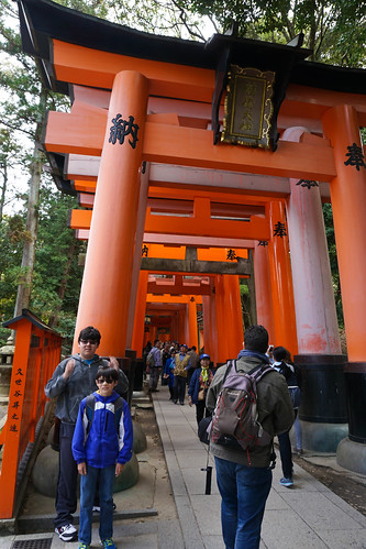
In the lower areas, the walkways are very crowded as you can see and everyone is trying to take their pictures. Some people are polite trying to give you space while others plow right through...
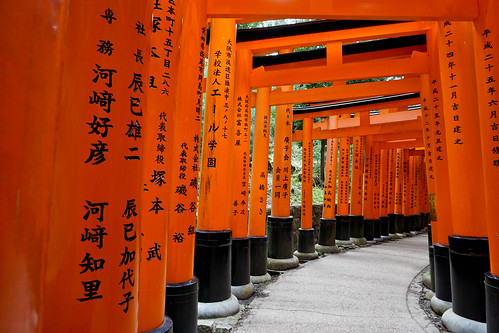
Big tip: there are plenty of opportunities to take more photos where people are no where to be seen.Be patient and willing to walk much further. This is where the many people either get tired or get slower.
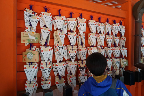
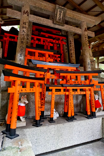
I'm not sure what's going on here but I know you can buy these fox faces. They have different faces and I'm not sure if people draw these faces on them or if you can do your own drawing. I don't see any blank ones. No, I see a couple of blank ones.
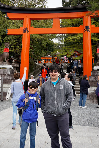
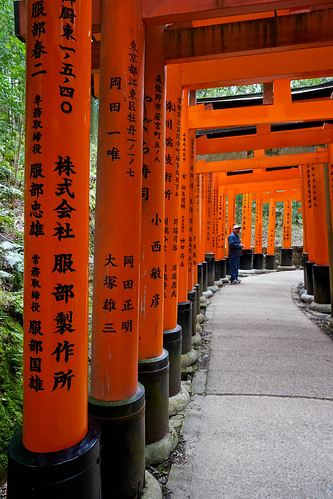
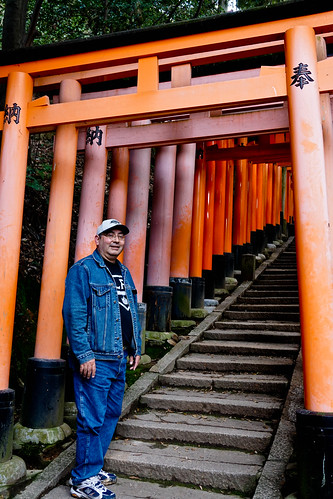
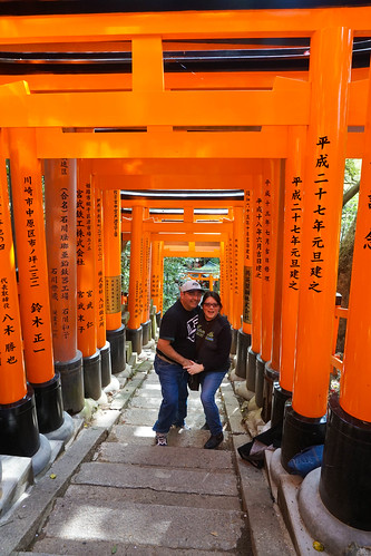
I have lots of pics of the torii gates which is what this shrine is all about.
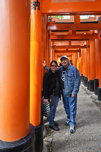
This shrine is for business/companies so the writing on the gate shows the sponsor and they're responsible for the maintenance/upkeep of the gate. Later in the photo set, you can see a worker painting one.
See? No one to be seen in our photo. Seriously, I think we walked 5-7 miles on that day just at the shrine.
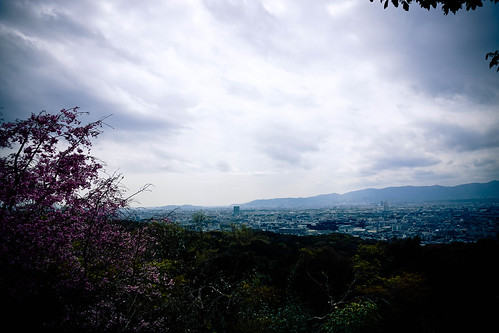
We did see the occasional couple. Keep hanging in there, we're almost to the summit. Not exactly the top but a big area overlooking the city. Remember I said there are shops, little tea/food areas up here so think about the people that work up here. Do they do rock, paper, scissors to see who works up at the top that day? I have some huge respect for the Japanese people.
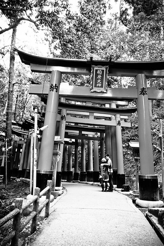
Off the main path, there are a few areas that have stairs leading to these shrines. Pretty cool.
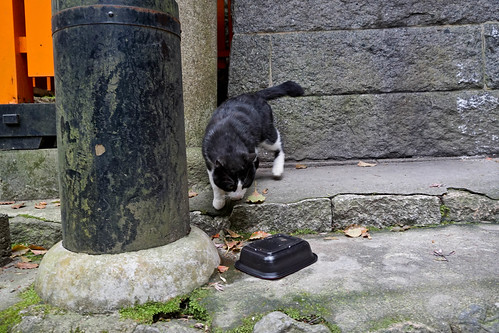
That's when we start noticing the feral cats. This is one of many that we saw in Kyoto. Most didn't seem too skittish but we didn't pet them. Another thing is that most of them have had something done to their tails. Either broken or chopped so that part is sad but it looks like someone is feeding them. Stay tuned for a later post of our time in a cat cafe.
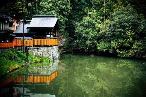
Now a break from shrines and gates...a little lake. If you want to see Hector and I go off the beaten path into the woods on a tiny dirt/mud path around half the lake before we went back to the main path, you can view them on Flickr.
What? More stairs?
Here's the rest point I was telling you about...it took us a while to get here, didn't it? Almost as long as it takes for me to do this post.
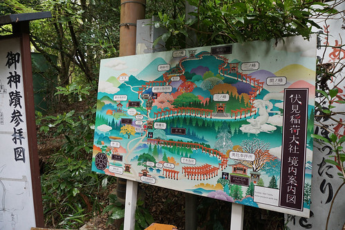
Here is my 2nd map photo. Now that I see this again, this map is different from the first one. That's why we were confused to where we were since the red dot moved but still in the middle of the map and that's what I remembered from the previous map.
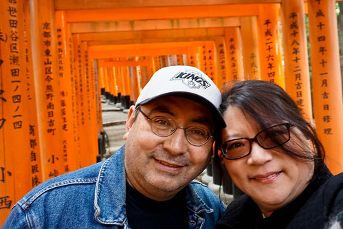
I'll end my super long post here. Somewhere in the upper half, we met a woman travelling alone from Mexico so we kept each other company the rest of the journey up. She had been in Japan for 2 weeks and she & Hector chatted a lot.
She took this photo of us and at the top of the shrine/mountain, we ran into our children which was super impressive because it is a super long hike. They took a different path up so that explained why we never ran into them. Family reunited. :)
No comments:
Post a Comment